Property Record
N27w23713 Paul Rd, Pewaukee, WI 53072

NEARBY LISTINGS FOR SALE OR LEASE
Property Detail
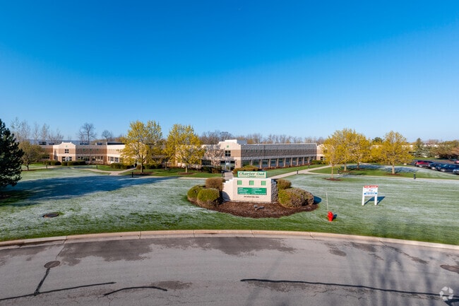
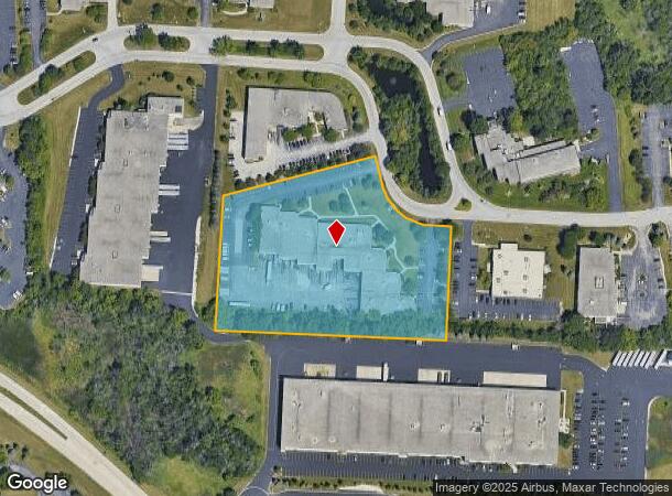
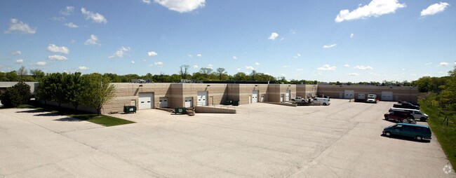
N27w23713 Paul Rd
Milwaukee-Waukesha-West Allis, WI
Certified Surv Map 7665
PWC-0918-998-023
LOT 5 BLK 3 CERT SURV 7665 VOL 65/268 5.249 AC PT NW1/4 SEC 14 T7N R19E DOC# 3771864
Commercialnec
Waukesha
X
Wisconsin
55133C0203H
5
2024
5.24 AC
2024
Central Waukesha
203308
Milwaukee/Madison
DEMOGRAPHICS near N27w23713 Paul Rd
1 Mile
3 Mile
5 Mile
2024 Total Population
3,823
25,965
113,157
2029 Population
3,844
26,565
116,764
Pop Growth 2024-2029
+ 0.55%
+ 2.31%
+ 3.19%
Average Age
45
42
42
2024 Total Households
1,918
10,973
48,256
HH Growth 2024-2029
+ 0.63%
+ 2.30%
+ 3.25%
Median Household Inc
$83,965
$88,655
$82,261
Avg Household Size
2.00
2.30
2.30
2024 Avg HH Vehicles
2.00
2.00
2.00
Median Home Value
$303,175
$354,745
$314,757
Median Year Built
1992
1987
1982
Nearby Places
Map Layers
Map Styles
 Street
 Aerial
- Restaurants
- Banks
- Shops
- Fitness
- Groceries
PUBLIC TRANSPORTATION
AIRPORT
General Mitchell International
DRIVE
WALK
Distance
General Mitchell International
39 min
24.0 mi
Freight Ports
Port Milwaukee
DRIVE
WALK
Distance
Port Milwaukee
31 min
20.5 mi
SALE & LEASE HISTORY
LISTING DATE
SALE/LEASE

Sep 25, 2016
For Lease
Sep 09, 2024
For Lease
Oct 12, 2021
For Lease
Jun 27, 2023
For Lease
Apr 11, 2018
For Lease
Nearby Properties
Address
Land Use
TOTAL SIZE
Lot Size
Zoning
Address
Land Use
TOTAL SIZE
Lot Size
Zoning
25.92 AC
Address
Land Use
TOTAL SIZE
Lot Size
Zoning
201,304 SF
29.43 AC
RM-2(PUD)
Address
Land Use
TOTAL SIZE
Lot Size
Zoning
172.13 AC
M-2
Address
Land Use
TOTAL SIZE
Lot Size
Zoning
Address
Land Use
TOTAL SIZE
Lot Size
Zoning
56.81 AC
Address
Land Use
TOTAL SIZE
Lot Size
Zoning
Address
Land Use
TOTAL SIZE
Lot Size
Zoning
Address
Land Use
TOTAL SIZE
Lot Size
Zoning
63,482 SF
39.53 AC
I-1
Address
Land Use
TOTAL SIZE
Lot Size
Zoning
Address
Land Use
TOTAL SIZE
Lot Size
Zoning
10.57 AC
Address
Land Use
TOTAL SIZE
Lot Size
Zoning
20.65 AC
Address
Land Use
TOTAL SIZE
Lot Size
Zoning
13.99 AC
Address
Land Use
TOTAL SIZE
Lot Size
Zoning
12.28 AC
Address
Land Use
TOTAL SIZE
Lot Size
Zoning
11.54 AC
M-1
Address
Land Use
TOTAL SIZE
Lot Size
Zoning
11.09 AC
Address
Land Use
TOTAL SIZE
Lot Size
Zoning
136.33 AC
M-2
Address
Land Use
TOTAL SIZE
Lot Size
Zoning
Address
Land Use
TOTAL SIZE
Lot Size
Zoning
5.23 AC
Address
Land Use
TOTAL SIZE
Lot Size
Zoning
16.47 AC
Address
Land Use
TOTAL SIZE
Lot Size
Zoning
4.87 AC
Address
Land Use
TOTAL SIZE
Lot Size
Zoning
22.81 AC
Address
Land Use
TOTAL SIZE
Lot Size
Zoning
180,616 SF
10.46 AC
B-5(PUD)
Address
Land Use
TOTAL SIZE
Lot Size
Zoning
11.92 AC
Address
Land Use
TOTAL SIZE
Lot Size
Zoning
18.57 AC
Address
Land Use
TOTAL SIZE
Lot Size
Zoning
15.45 AC
Address
Land Use
TOTAL SIZE
Lot Size
Zoning
11.02 AC
Address
Land Use
TOTAL SIZE
Lot Size
Zoning
17.66 AC
Address
Land Use
TOTAL SIZE
Lot Size
Zoning
Address
Land Use
TOTAL SIZE
Lot Size
Zoning
Address
Land Use
TOTAL SIZE
Lot Size
Zoning
5.01 AC
The World's #1 Commercial Real Estate Marketplace
Connect with us
© 2025 CoStar Group
The information above has been obtained from sources believed reliable. While we do not doubt its accuracy we have not verified it and make no guarantee, warranty or representation about it. It is your responsibility to independently confirm its accuracy and completeness. Any projections, opinions, assumptions, or estimates used are for example only and do not represent the current or future performance of the property. The value of this transaction to you depends on tax and other factors which should be evaluated by your tax, financial, and legal advisors. You and your advisors should conduct a careful, independent investigation of the property to determine to your satisfaction the suitability of the property for your needs.